Flying Weather Maps Page
E komo mai (Welcome)
| Prognosis Charts | |||
Current 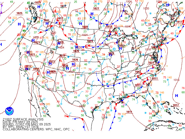 > > |
6 Hr.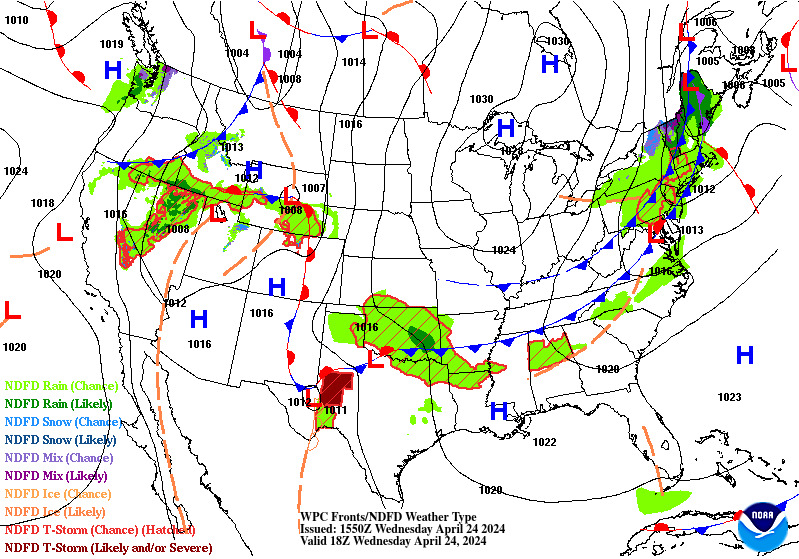 |
12 Hr. |
24 Hr. |
36 Hr.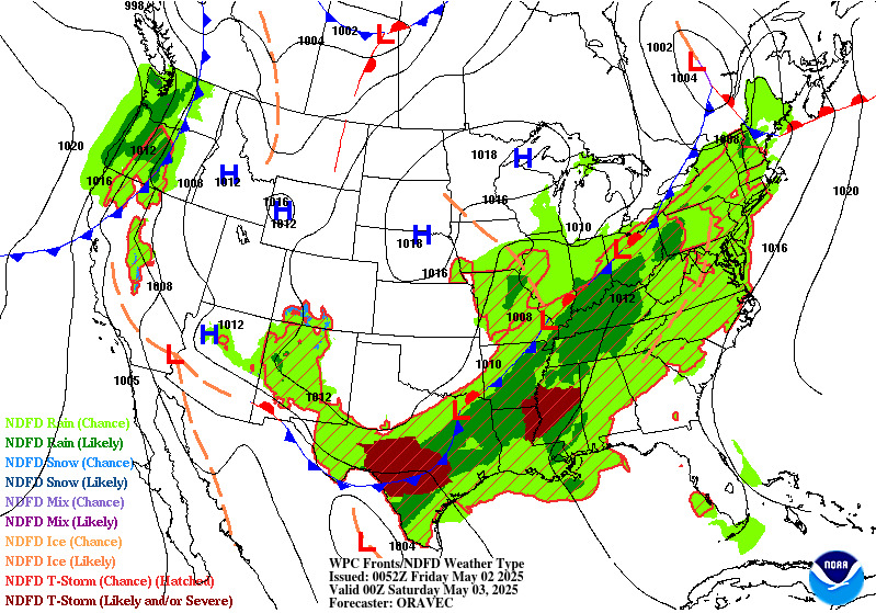 |
48 Hr.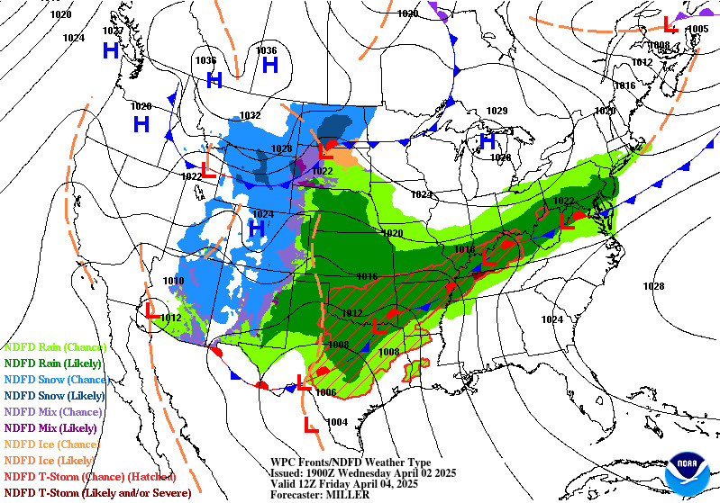 |
48 Hr.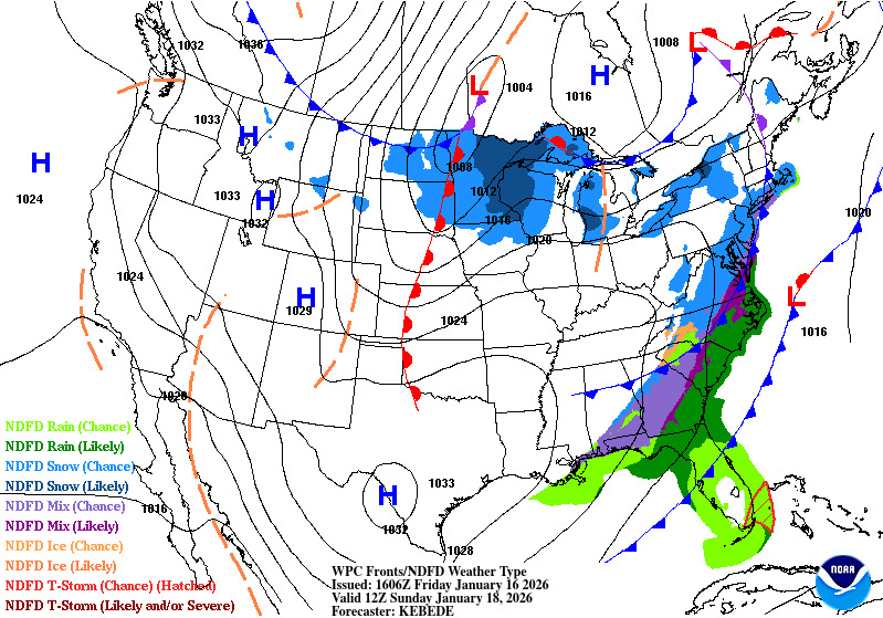 |
HI |
| Surface Analyses and Short Range Forecasts | |||
| Hawaii Analyses/Forecasts | |||
 WXbrief
NOAA Aviation Weather Center
WXbrief
NOAA Aviation Weather Center

"When once you have tasted flight, you will walk the Earth with your eyes turned skyward, for there you have been and there you long to return." — Leonardo DaVinci